Maps and Travel
Huddersfield is located between Leeds and Manchester. In this section is everything you need to find us, no matter where you are coming from.
Full Postal Addresses:
Queensgate
Huddersfield,
West Yorkshire
HD1 3DH
01484 422 288
Approx journey times (by car) to Queensgate Campus:
- London – 3 hours 30 mins
- Gatwick Airport (London) – 4 hours
- Heathrow Airport (London) – 3 hours 30 mins
- Liverpool – 1 hour 20 mins
- Leeds – 30 mins
- Leeds/Bradford Airport – 45 mins
- Manchester – 50 mins
- Manchester Airport – 1 hour
- Newcastle – 2 hours 20 mins
Coming to Huddersfield by car? Find out more about car parking at the University and around the town.
The closest major airport to the University is Manchester International Airport, which connects with most international cities.
For further local and national transport information click the links below.
Directions to the Queensgate Campus from the bus and railway stations.
http://www.thetrainline.com/buytickets/
http://www.mytrainticket.co.uk/ (My train ticket provides rail journey planning and is an online impartial retailer that sells train tickets for all UK train companies to all National Rail destinations, London Underground stations and over 275 Plusbus locations.)
http://www.kirklees.gov.uk/visitors/ (Kirklees Council Visitors Guide)
http://www.wymetro.com/ (Metro (West Yorkshire) Link to local journey planner and live departure information)
http://www.northernrail.org/ (Northern Rail Website, local train information and journey planner)
http://www.nationalrail.co.uk/ (National Rail Enquiries)
http://www.tpexpress.co.uk/train-destinations/huddersfield/overview/ (TransPennine Express - purchase tickets for travel from any UK train station with no online booking fees)
http://huddersfieldactivetravel.co.uk/ The Huddersfield Active Travel Project offers information and advice on local walking, cycling, bus and train routes. They also offer a number of free activities and workshops including led rides and walks, bicycle safety checks, cycling and cycle maintenance training.
http://www.sustrans.org.uk/ A charity enabling people to choose healthier, cleaner and cheaper journeys.
As a student, no matter how old, you can get a Metrocard for use on all buses and trains in West Yorkshire. You can get more information from the Metro (link as above) website or by visiting your local train or bus station. Metrocards are also available from any Post Office.
Queensgate Campus Maps
3D campus map
View/download - Campus Map
You can view a visual representation of our Queensgate (Huddersfield) campus using this 3D perspective map.
Accessible route map
View/download -
Please note: you will need to have a certain level of access on your card to enter at certain points on the route. Please contact Estates if you have any queries on tel: 01484 472351 or email: estates@hud.ac.uk
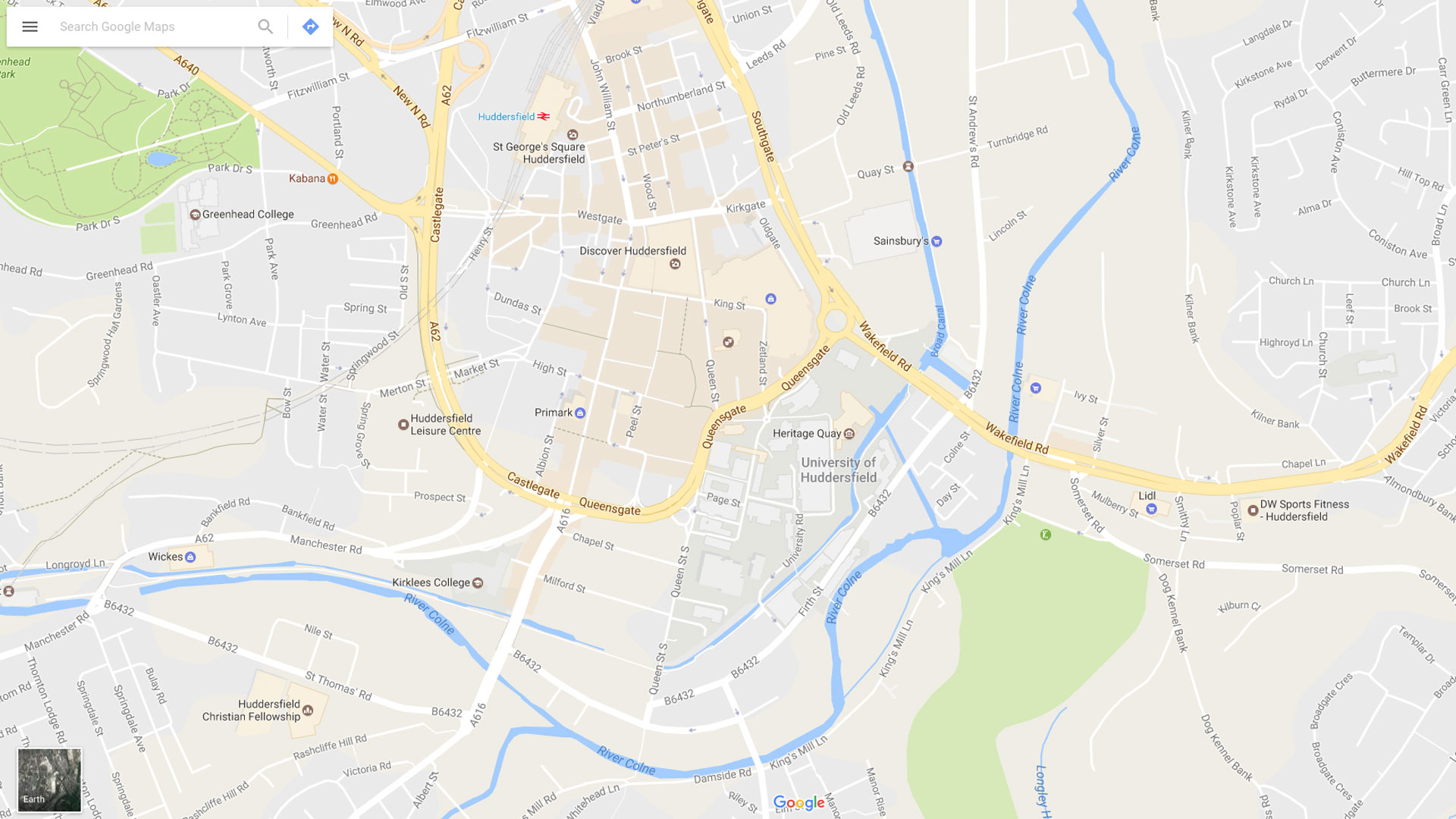
Huddersfield Town Maps
We've included a map from Google (above) to make it easy to see the surrounding area of the town. Below, you can also find PDF maps of the town and the United Kingdom.
Town roads map
See an overview of main roads leading to and from Huddersfield town.
Download - Town Road map
Our local authority, Kirklees Council, has some useful roads and travel information on their website.
Where is Huddersfield?
See Huddersfield in relation to other parts of the UK by taking a look at this map, suitable for print.
Colour (PDF, 47KB) | Black & White (PDF, 59KB)
This map also lists most major mainland motorways.